About ClimateAP
ClimateAP is a standalone MS Windows application that downscales PRISM and WorldClim 1961-1990 gridded monthly climate
normal data (4 km x 4 km) to scale-free point locations. It is developed and maintained by the University of British Columbia (UBC)
and sponsored by the Asia-Pacific Network for Sustainable Forest Management and Rehabilitation (APFNet). All data generated using ClimateAP are subject to the CC-BY license.
ClimateAP calculates and derives many (>200) monthly, seasonal and annual climate variables. ClimateAP also uses
the scale-free data as a baseline to downscale historical and future climate variables for individual years and periods between 1901 and 2100. ClimateAP covers Asia Pacific
areas (shown below). To download the package, please click here. For scale-free climate data in North America, please visit ClimateNA.

Main features
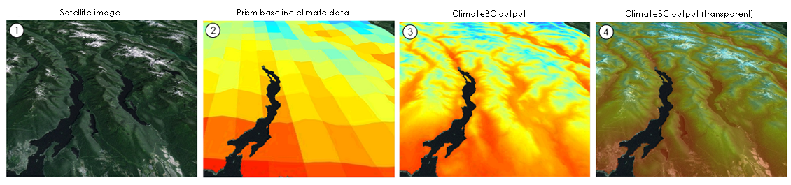
1. Scale-free climate data
ClimateAP generates scale-free climate data that facilitates users to obtain climate data for specific locations (instead of grid averages) and climate surfaces at any spatial resolutions.
2. All-in-one package
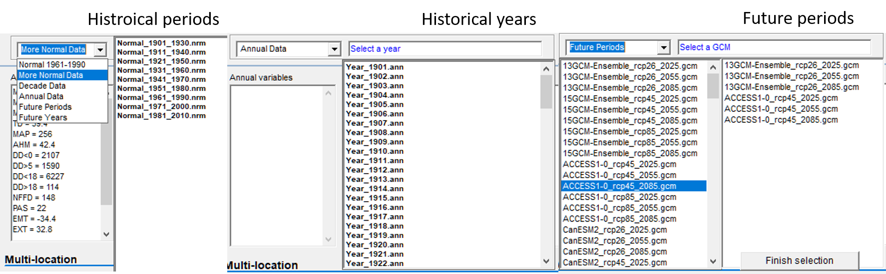
ClimateAP integrates and downscales climate data for historical and Future periods and years.
3. Multiple-location processing
ClimateAP can process almost unlimited number of locations in a single run.
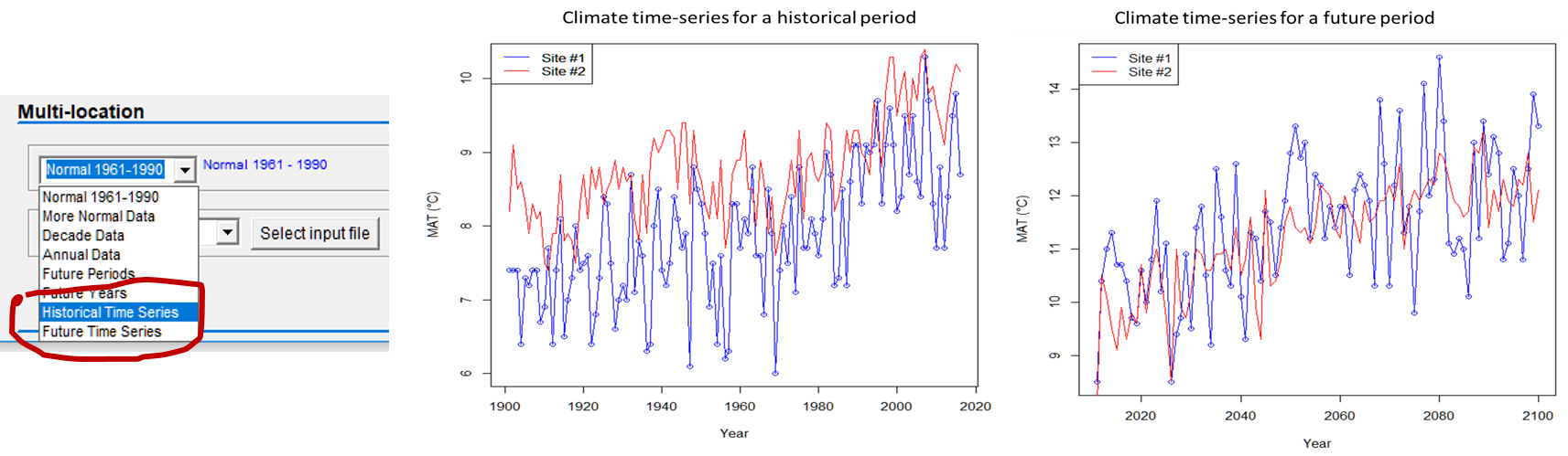
4. Time-series functions
ClimateAP can generate time-series climate data for historical (1901-2018) or future years (2011-2100) for multiple locations in a single run.
5. Map-based version for easy access and spatioal visualization
ClimateAP map-based version allows uses to: 1) get climate data for a location by clicking on the map; 2) visualize the spatial distribution of main climate variables; 3) visualize forest ecotypes and their shift in future climates; and 4) Visualize forest tree species distributions. Please click on the map to access the map-based version.

6
. Map-based climate models for individual economies
The map-based version is available for five economies in Asia-Pacific: China, Chinese Taipei, Laos, Myanmar and Malaysia.
